
Control Network
A field app for control surveys and traverse work — preset tolerances, live accuracy checking during observation, and export to your adjustment software.
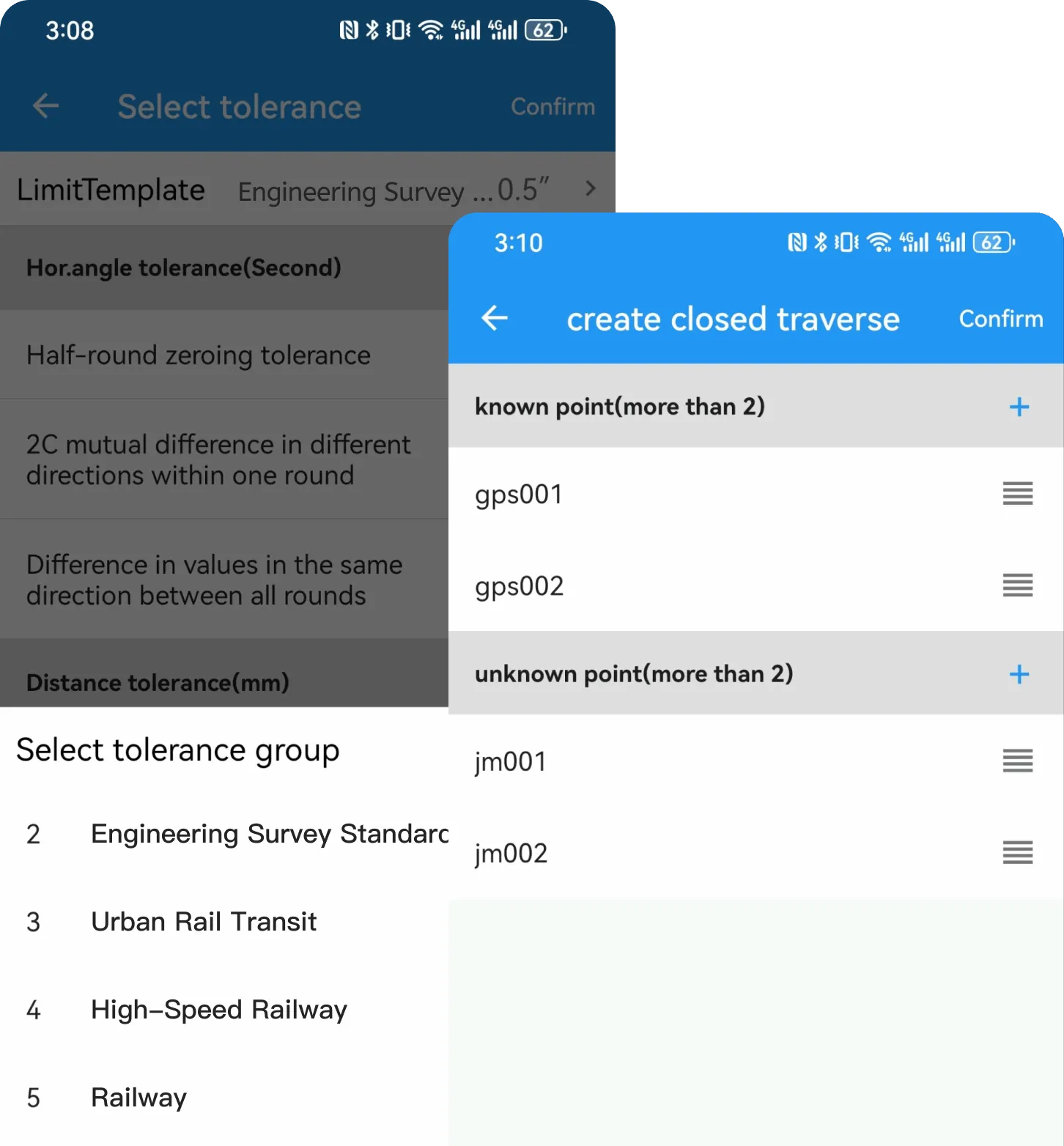
Four project types, four observation workflows
Observation workflow and observation templates differ by project type. Choose the one that matches the job.
Triangulation Traverse
General control surveys, with no limit on the number of observation targets. The project is the basic structure and is organised hierarchically: a project holds point information and survey epochs, each epoch contains stations, and the station is the unit that executes measurements.
Connection Survey
For shaft connection surveys, covering one-shaft orientation and two-shaft orientation. Connection survey projects display horizontal distance by default.
Elevation Traverse
Trigonometric levelling projects, with survey epochs and stations set up separately from the planimetric control. Stations can be laid out with alternate point station setup (the middle method) or every point station setup, and geoid non-parallelism correction can be computed.
Leveling
Ordered levelling projects organised by leveling section, including section configuration and i-angle check. A section can define its sighting order and observation direction, and supports forward run / backward run combinations.
Station order follows the traverse shape
The software derives the observation order from the traverse shape and generates the station list for you.
Closed Traverseloop traverse
Starts and ends at the same known point.
- Points required
- 2 Control Points + ≥2 Unknown Points
- Notes
- The closed loop itself provides a checking condition.
Connected Traverse
Starts at one known control point and ends at another known control point. The control points may or may not have an orientation side connected to them.
- Points required
- 4 Control Points + ≥1 Unknown Point
- Notes
- Two orientation sides act as a check and give higher accuracy, at the cost of stricter demands on the number and layout of control points.
Open Traversefree traverse
Starts from a known point, sets up the station at each unknown point in sequence to measure angles and distances, and does not return to the starting point or close on any other known point.
- Points required
- 2 Control Points + ≥1 Unknown Point
- Notes
- An open traverse cannot be checked, so extra care is needed during layout and observation.
Non-oriented Traverse
Starts from one known control point and ends at another — a connected traverse with the orientation edges on both sides removed, but with a completely different calculation method.
- Points required
- 2 Control Points + ≥1 Unknown Point
- Notes
- Suited to projects that have just started, where control points are few or the original ones have been destroyed. No intervisibility between control points is required.
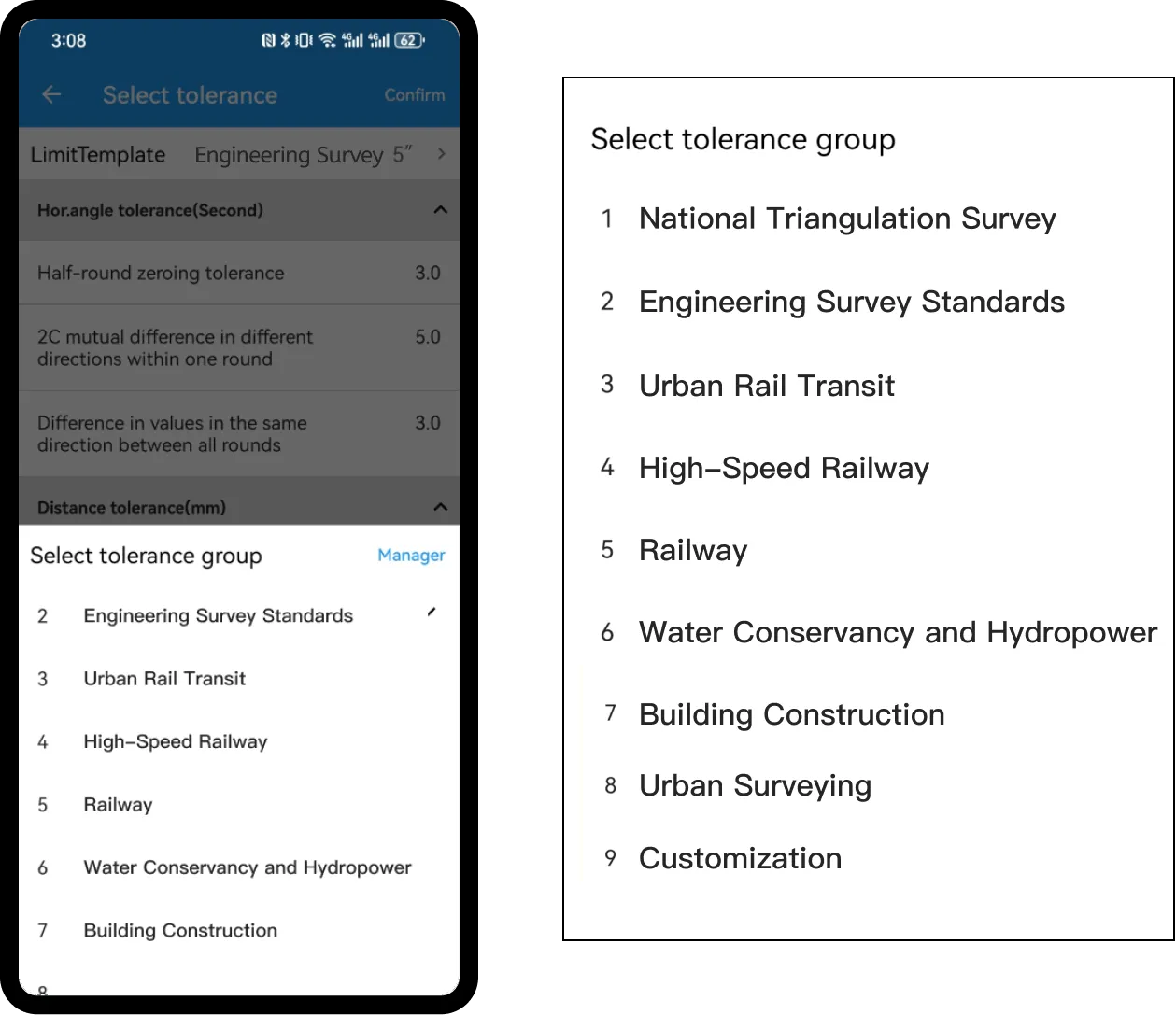
Preset Specification Tolerance Scheme
The software has preset tolerance values according to various national standards, including engineering surveying, urban rail transit, high-speed rail, and railway. Users can select the appropriate tolerance values within the configuration group based on project requirements and instrument accuracy.
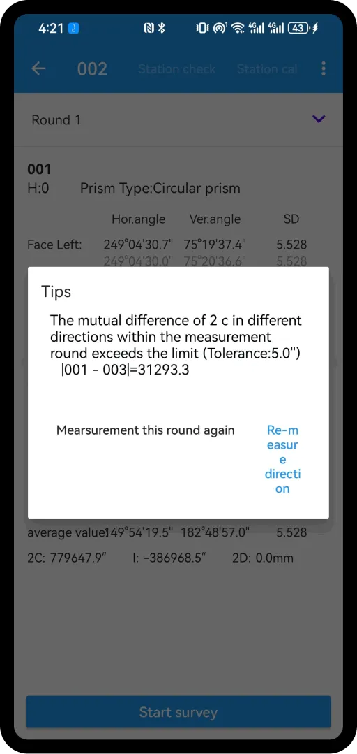
Real-time monitoring of observation accuracy
Automatically prompts the user to perform direct and reverse measurements, ensuring the survey process is accurate. During the observation, it automatically detects measurement tolerances, and if limits are exceeded, the user can opt for re-measurement.
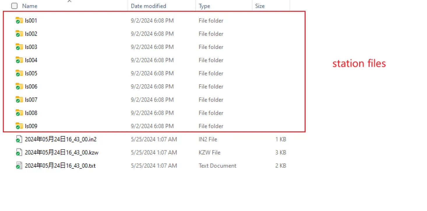
Data Output
The software supports exporting raw observation data in various formats, such as Control Network format, straightforward format, and Easy Adjustment format.
Works with the instruments you already own
Angles and distances are read straight from the instrument and recorded automatically.
Total stations
Connects to most total stations on the market, reading angles and distances from the instrument and recording them automatically.
These are the common brands. Contact us about brands not listed here.
Digital levels
Connects to digital levels to acquire measurement data.
Covers the mainstream digital level brands; most connect through a Bluetooth adapter.
Field records are no longer written by hand
Instrument readings → written down by hand → typed in back at the office
Collected on the phone and uploaded to the cloud → downloaded on a PC for adjustment